 Autobahn-Tempolimit
Contents
How to find the nearest free stretch
A static list can never tell you what is near you – but the map can. It works in any browser on phone or desktop, with no app and no sign-up:
- Open the map and allow location access when asked. It recentres on where you are.
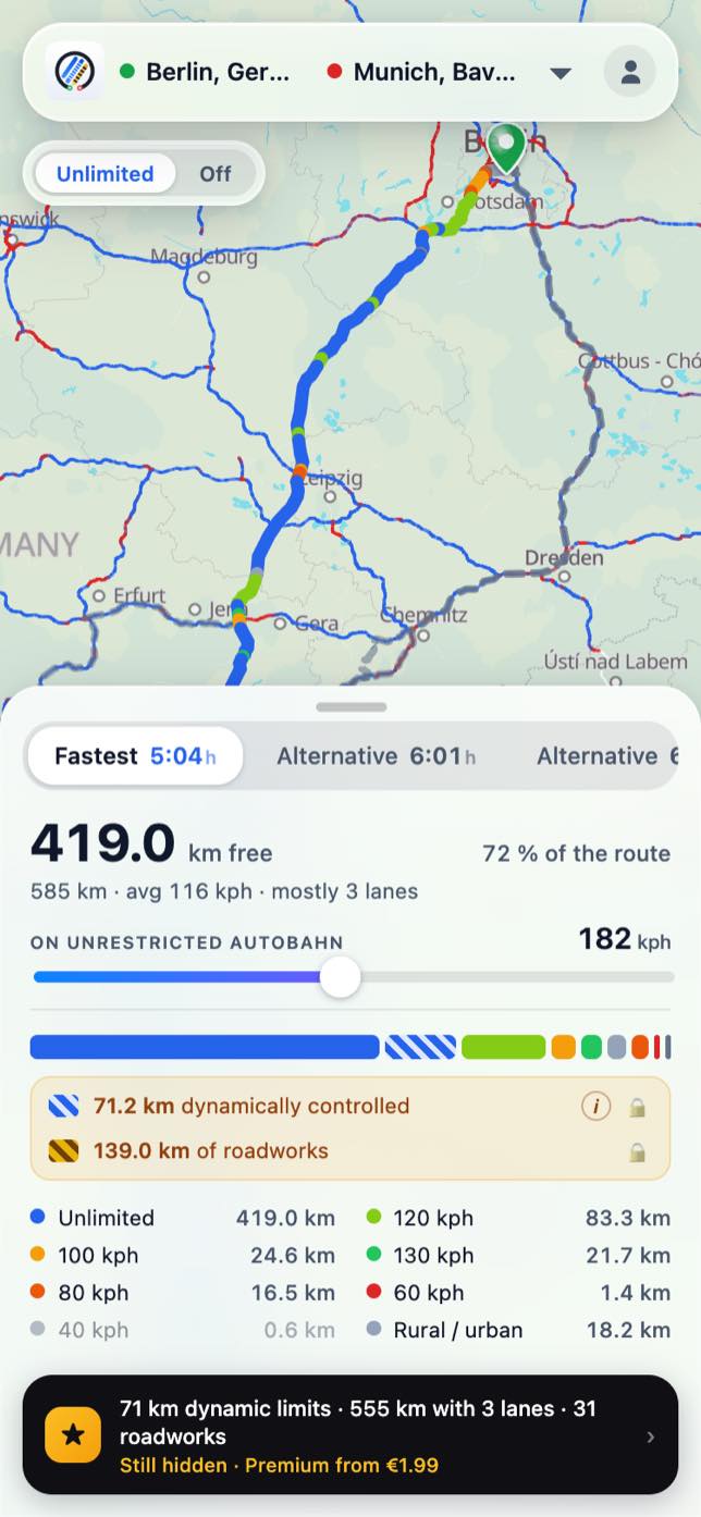
- Look for the blue sections. Blue is unrestricted; other colours mark a fixed limit, a stretch controlled by variable digital speed limit signs or roadworks.
- Zoom to your area to see exactly where a free section starts and ends – down to the individual junction.
- Tap a route from start to destination to see how many of your kilometres are actually open.
The big open corridors, by region
If you want to plan a drive rather than just check your doorstep, these are the autobahns with the highest unrestricted share – grouped roughly by where they run. All figures are directional-carriageway kilometres from our own data.
| Autobahn | Where it runs | no limit | Share as a bar |
|---|---|---|---|
| A 20 | Baltic coast, Schleswig-Holstein | 91.8% | |
| A 19 | Rostock – Berlin | 90.6% | |
| A 24 | Hamburg – Berlin | 87.9% | |
| A 31 | Emsland, north-west | 89.0% | |
| A 30 | Osnabrück – Dutch border | 85.6% | |
| A 33 | Bielefeld – Osnabrück | 84.9% | |
| A 38 | Göttingen – Leipzig (central) | 91.2% | |
| A 14 | Saxony, Saxony-Anhalt | 82.6% | |
| A 36 | Braunschweig – Harz | 83.2% | |
| A 70 | Franconia (northern Bavaria) | 82.4% |
The full picture is in the ranking of the most derestricted autobahns, and section by section on the autobahn no-speed-limit map.
Why it depends on where you are
There is no single national answer to "is there an unrestricted autobahn near me", because free road is not spread evenly. The open stretches sit mainly in the north and east – along the Baltic coast, between Hamburg, Berlin and the Saxon cities, and across the thinly populated north-west. There, lower traffic and population density mean fewer fixed limits for noise or safety.
In the dense city regions it is the opposite: around the Rhine and Ruhr, and near Munich, Stuttgart or Frankfurt, most of the autobahn carries a fixed or variable limit. If you live there, the nearest genuinely open stretch may be an hour's drive away – which is exactly why checking the map first beats guessing.
Frequently asked questions
How do I find the nearest unrestricted autobahn?
Open the map and allow location access. It recentres on where you are and colours every section by speed limit – blue means no limit. Zoom in to see exactly where a free stretch begins and ends.
Is there an unrestricted autobahn near me?
It depends on your region. The north and east are largely open; the Rhine-Ruhr area and the big southern cities mostly are not. The map shows the free sections around your location precisely, so you do not have to guess.
Which regions have the most free autobahn?
The north and east lead. The A20 on the Baltic coast is 91.8% unrestricted, the A19 (Rostock–Berlin) 90.6% and the A24 (Hamburg–Berlin) 87.9%. In central Germany the A38 reaches 91.2%.
Do I need an app to see it?
No. The map runs in any browser on phone or desktop, with no app and no sign-up. Location access is optional – it just saves you from scrolling to your area by hand.
Data source: our own analysis of the OpenStreetMap data, as of 27 July 2026. Directional-carriageway kilometres. Not an official survey.
Read on
Autobahn no-speed-limit map
The whole network coloured section by section – where there is no limit.
The rankingThe most derestricted autobahns
A20, A38, A19: which routes are the most open – with kilometres.
The basicsWhere is there no speed limit?
On 64.7% of the network it is open – map, list and the exact kilometres.
In practiceCalculate your driving time
Why every sat-nav reckons with 130 – and how to get your real arrival.
StraightsThe longest straights
Where you drive straight the longest – with coordinates.
Insider tipUnrestricted country roads
Where there is no limit off the autobahn – the B15 with 34 km free.